
 • For a Google map and directions, click this link, then click on "Directions." It will give you the driving distance and the approximate driving time to get here.
• For a chart, scroll down to the bottom on this page.
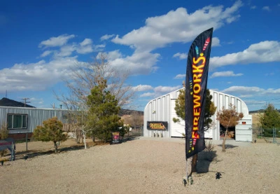
• We are located at 700 North Main Street, Goldfield, Nevada 89013.
Important Information - Please read
• The speed limit on U.S. Highway 95 is 70 miles per hour, but where Highway 95 goes through Goldfield, Tonopah, Hawthorne or Beatty, it’s 25 miles per hour and they are strict.
• Fill up in Beatty, Tonopah or Big Pine. Goldfield only has an electric charging station, and that's it. They are building a station in Goldfield, but it's not open yet. Be sure to fill up your tank in the last town you go through before Goldfield. Depending on where you started started from, the last town will be either Beatty, Nevada, Tonopah, Nevada or Big Pine, California.
• CAUTION when using GPS systems or Google directions! Don't drive to Silver Peak, Nevada, even if your GPS or other navigation system suggests that you do. Google or other GPS send you this way because it is a few miles shorter. But part of it is a dirt road, and there are no gas stations or food. Don't go that way. Stay on Highway 95 and go through Tonopah, Nevada, NOT Silver Peak. You will have food and fuel options in Tonopah. Stay on 95 until you get to Goldfield. If your GPS or other directions send you onto a dirt road, don't go that way. It is possible to get here entirely on paved roads.
That's the end of the important information.
Directions from common starting points
• From Bishop, California, take U.S. 6 north, to U.S. 95 south. Total drive is 142 miles, with a driving time of 2:24.
• From Los Angeles, California, the shortest route is via California 14 north to U.S. 395 north, to California 168 east, through the Inyo Mountains and then turn right on Nevada 266 at Oasis, California, go up over Lida Summit, then turn left on U.S. 95 to Goldfield. This route is 349 miles with a driving time of 6 hours.
• From Sacramento, California, there are several routes. The shortest is to take U.S. 50 east to U.S. 395 south to CA 120 east, to U.S. 6 east to Tonopah, then 95 south. If U.S. 395 is closed due to snow, an alternate route is to go through Yerington, Nevada, then U.S. 95 south to Goldfield. Sacramento to Goldfield is 365 miles with a driving time of 6.5 hours.
• From the Central Valley of California (Stockton, Modesto, Fresno, etc.), we recommend taking Highway 120 through Yosemite National Park (you will have to pay a $35 fee to pass through the park, which is good for 1 week), then 120 east to U.S. 6 east to Tonopah, then 95 south to Goldfield. This route (Modesto to Goldfield) is 326 miles with a driving time of 6.5 hours. The 120 route is only open in the warmer months. If 120 is closed you may need to use CA 88 or US 50 to cross the Sierra Nevada.
• From Reno or Lake Tahoe, take U.S. 95 south to Goldfield. This route is 264 miles with a driving time of 4:18.
• From Las Vegas, take U.S. 95 north to Goldfield. It is 184 miles, with a driving time of 3 hours.
• From Tonopah or Round Mountain, Nevada, take U.S. 95 south from Tonopah for 26 miles. It is about 25 minutes south of Tonopah.
More Specific Directions and Maps
Bishop, California to Goldfield, Nevada:
The quickest way is to take U.S. 6 north from Bishop, to Tonopah, Nevada, and then continue south on U.S. 95 from Tonopah to Goldfield. This is a total of 142 miles, with a driving time of 2.5 hours. Please note that there is an agricultural checkpoint on westbound U.S. Highway 6, just after you enter California from Nevada, and just before Benton, California.
The other way is to take California 168 east from Big Pine, California, over the Inyo Mountains and then Nevada 266 east over Lida Summit, then U.S. 95 north to Goldfield. This is 98 miles and takes 2 hours, and there is no cell phone service for most of the way. It is paved highway the whole way. Please make sure your tank is full when you leave Big Pine.
Los Angeles to Goldfield, Nevada:
Click for map • We recommend taking Interstate 5 north to California 14 north, to U.S. 395 north to Big Pine, California. Fill up your tank completely full in Big Pine, then take California 168 east from Big Pine, through the Inyo Mountains, and then turn right on Nevada 266, at Oasis, California, go over Lida Summit, then turn left on U.S. 95 to Goldfield. This route is 349 miles with a driving time of 6 hours. This is a highly scenic route, but there are many curves on this route, and long stretches with no cell phone service. It is paved highway the whole way. Please make sure your car is in top shape, though, and that your tank is full when you leave Big Pine. Please call or text us at (775) 277-9284 when arriving in Goldfield, and we will guide you to the shop.
Las Vegas to Goldfield, Nevada:
Click for map • Simply take U.S. 95 north from Las Vegas to Goldfield. 189 miles or just over 3 hours. Please call or text us at (775) 277-9284 when arriving in Goldfield and we will guide you to the shop.
Reno, Nevada to Goldfield, Nevada:
Click for map • Take Interstate 80 east to Nevada 439 south to Alt-US 95 south to US 95 south. Total distance is 255 miles with a drive time of 4 hours and 23 minutes. Please call or text us at (775) 277-9284 when arriving in Goldfield and we will guide you to the shop.
San Francisco, California to Goldfield, Nevada:
Click for map • Many of our customers use this route as it is the shortest from the Bay Area. However, this route requires driving through Yosemite National Park, which has an entrance fee of $35 for the car. That fee is good for 7 days, so be sure to save your receipt and show it at the gate when you go back, and you won't have to pay that again. Also, Yosemite National Park now requires a reservation to enter, if you enter the gate between 6:00 a.m. and 4:00 p.m. The park's web site states that the reservations will be required from May 20 to September 30, but only for cars entering between 6:00 a.m and 4:00 p.m. For more detailed information on this, please see the park's web site.
This route involves mountain driving with many curves. This route is possible to use only when California Route 120, Tioga Road and Tioga Pass are open. The date they open varies from year to year, but typically they try to get it open before Memorial Day weekend. If part of Route 120 is closed (and it is closed all winter), a longer, alternate route is required. That could be either California Route 108, California Route 4 or California Route 88. All of these involve mountain driving with many curves. They try to keep 88 open all year, but in the winter they may require chains on the tires. If you want to buy fireworks for New Year's Eve, we highly recommend coming here in October, when all roads are still dry and safe and all mountain roads are usually still open.
Take Interstate 580 east, to California 120 east, through Yosemite, to Lee Vining, to U.S. Route 395 south for 4 miles, then continue on California 120 east, to U.S. Route 6 east, to U.S. Route 95 south. This route is 391 miles, and is 9 hours of driving plus time spent at stops along the way, so for most people it is a 10 or 11-hour drive.
Driving Times and Distances
The driving times listed below are only estimates, based on driving exactly the speed limit. We recommend obeying all speed limits and traffic laws, especially in small towns. The speed limit on U.S. Highway 95 is 70 miles per hour, but where Highway 95 goes through Goldfield, Tonopah, Hawthorne or Beatty, it’s 25 miles per hour and they are strict.
| Estimated Driving Times | ||||
| Driving times shown do not include stops along the way. For mountain routes, please consult Nevada DOT or Caltrans for current road conditions. |
||||
| From | Distance to Goldfield |
Driving Time to Goldfield |
||
| Amargosa Valley, NV | 96 miles | 1:24 | ||
| Anaheim, CA (Disneyland) | 374 miles | 5:52 | ||
| Ancient Bristlecone Pine Forest, CA | 91 miles | 2:02 | ||
| Baker, CA | 203 miles | 3:20 | ||
| Bakersfield, CA | 309 miles | 5:43 | ||
| Barstow, CA | 265 miles | 4:01 | ||
| Beatty, NV | 67 miles | 1:06 | ||
| Big Pine, CA | 98 miles | 1:56 | ||
| Bishop, CA | 142 miles | 2:24 | ||
| Boise, ID | 540 miles | 8:48 | ||
| Carson City, NV | 251 miles | 4:04 | ||
| Death Valley National Park, CA | 107 miles | 1:48 | ||
| Denver, CO | 921 miles | 13:23 | ||
| Elko, NV | 297 miles | 4:39 | ||
| Ely, NV | 194 miles | 3:15 | ||
| Fallon, NV | 202 miles | 3:07 | ||
| Fresno, CA* (summer route) | 335 miles | 6:26 | ||
| Grand Canyon National Park, AZ | 459 miles | 6:45 | ||
| Hawthorne, NV | 130 miles | 1:58 | ||
| Hesperia, CA | 307 miles | 4:44 | ||
| Lake Tahoe, CA | 261 miles | 4:21 | ||
| Las Vegas, NV | 189 miles | 3:16 | ||
| Lee Vining, CA | 158 miles | 2:38 | ||
| Lone Pine, CA | 140 miles | 2:34 | ||
| Los Angeles, CA | 349 miles | 6:10 | ||
| Mammoth Lakes, CA | 154 miles | 2:44 | ||
| Moapa, NV | 224 miles | 3:17 | ||
| Pahrump, NV | 141 miles | 2:08 | ||
| Phoenix, AZ | 469 miles | 7:44 | ||
| Portland, OR | 785 miles | 12:57 | ||
| Reno, NV | 264 miles | 4:31 | ||
| Round Mountain, NV | 86 miles | 1:26 | ||
| Sacramento, CA | 396 miles | 6:32 | ||
| Salt Lake City, UT | 436 miles | 6:38 | ||
| San Diego, CA | 447 miles | 7:06 | ||
| San Francisco, CA* (summer route) | 411 miles | 10:07 | ||
| Schurz, NV | 164 miles | 2:31 | ||
| Sequoia National Park, CA | 403 miles | 6:44 | ||
| Shoshone, CA | 154 miles | 2:24 | ||
| St. George, UT | 293 miles | 4:16 | ||
| Tecopa, CA | 159 miles | 2:29 | ||
| Tonopah, NV | 27 miles | 0:26 | ||
| Victorville, CA | 297 miles | 4:30 | ||
| Winnemucca, NV | 284 miles | 4:20 | ||
| Yellowstone National Park, WY | 713 miles | 11:16 | ||
| Yosemite National Park, CA (Tioga Pass entrance)* (summer route) | 188 miles | 3:12 | ||
| Zion National Park, UT | 333 miles | 5:02 | ||
| For those destinations marked (*), the time and distance are accurate only when all mountain roads are open. If mountain roads are closed, the time and distance will be longer. | ||||